Overview
During the American Revolution, maps played a crucial role in the strategic planning and execution of military campaigns. These maps served as valuable tools for both the British and American forces, helping them navigate the challenging terrain and identify key locations for tactical advantages. Surveyors and cartographers were often commissioned to create accurate maps, documenting the topography, waterways, and important landmarks. These maps provided essential information for troop movements, scouting, and identifying defensive positions. Additionally, they were instrumental in planning major battles such as Saratoga and Yorktown, where understanding the geographical features played a significant role in determining the outcome of the conflicts.

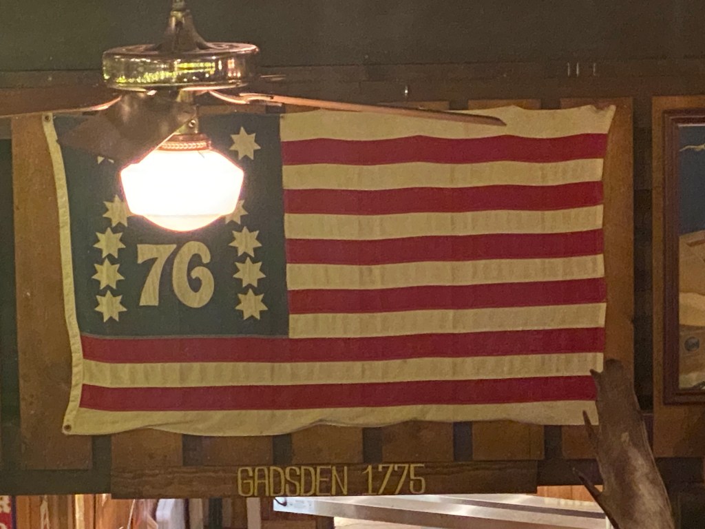
Flags were also significant symbols during the American Revolution, representing the aspirations, values, and allegiances of the different factions involved. The most famous flag associated with the American Revolution is the Stars and Stripes, which would eventually become the flag of the United States. However, during the revolutionary period, various flags were used by different groups. The British Union Jack represented the authority and control of the British Empire. At the same time, the American colonists initially used the Grand Union Flag, featuring the Union Jack in the canton and thirteen red and white stripes, representing the thirteen colonies. As the war progressed, other flags emerged, such as the Betsy Ross flag with thirteen stars in a circle, symbolizing the unity of the colonies, and the Gadsden flag, depicting a coiled rattlesnake with the slogan “Don’t Tread on Me.” These flags not only served as rallying symbols but also conveyed the ideals of liberty, independence, and resistance against oppressive rule.
Primary Sources
Colonial Protest Maps – Pictures and descriptions of flags used by Americans to protest British rule in the thirteen colonies before the Revolutionary War.
Secondary Sources
“A Vision for American Empire — Commanding Space after the Seven Years’ War — Securing the Maritime Northeast — Markin,” n.d.
Barnes, Ian, and Charles Royster. The Historical Atlas of the American Revolution. New York: Routledge, 2000.
Barker, Thomas M., and Paul R. Huey. “The 1776-1777 Northern Campaigns of the American War for Independence and Their Sequel: Contemporary Maps of Mainly German Origin.” Fleischmanns, NY : Vergennes, VT: Purple Mountain Press ; The Lake Champlain Maritime Museum, 2010.
Brown, Richard H., and Paul E. Cohen. “Revolution: Mapping the Road to American Independence, 1755/1783.” New York, N.Y: W.W. Norton & Company, Inc, 2015.
Edelson, S. Max. The New Map of Empire: How Britain Imagined America before Independence. Cambridge, Massachusetts: Harvard University Press, 2017.
Higginbotham, Don. Atlas of the American Revolution. Edited by Kenneth Nebenzahi. Chicago: Rand McNally & Company, 1974.
Revolutionary War Flags still fly today!

Grand Union Flag